Acoustic Waves Accelerate Real-Time Seismic Imaging!
A cutting-edge remote sensing technique capable of detecting real-time subsurface changes has been successfully tested near the KAUST (King Abdullah University of Science and Technology) campus in Thuwal, Saudi Arabia.
Understanding Seismic Imaging
Seismic imaging is an increasingly utilized technique to bypass the time-consuming and destructive effects of drilling. This method employs sonic sources strategically placed at specific locations to send acoustic waves into the subsurface. By measuring the time it takes for these waves to return to surface-level receivers, researchers can infer underground properties such as stiffness, density, or porosity. This allows for the identification of features like underground water pockets or distinct geological structures.
Challenges with Traditional Methods
KAUST geophysicist Gerard Schuster highlights the limitations of conventional seismic imaging in capturing real-time geological events.
“Traditional seismic experiments require capturing data from numerous angles to accurately analyze the subsurface. This necessitates deploying sound sources at hundreds of locations, which is both time-intensive and laborious,” Schuster explains.
To overcome this challenge, Schuster has spent the last two decades investigating the cyclic patterns of acoustic waves and the phase shifts that occur as these waves traverse various materials. Phase shifts, which indicate how waves are delayed or redirected, provide critical insights. By leveraging these shifts, Schuster asserts that high-resolution imaging can be achieved with significantly fewer sound sources.
“This approach reduces the effort required,” Schuster notes. “By analyzing time delays between wave phases, we can address questions about geological properties like stiffness and porosity with just a few experiments instead of hundreds.”
Accelerated Experiments and Key Insights
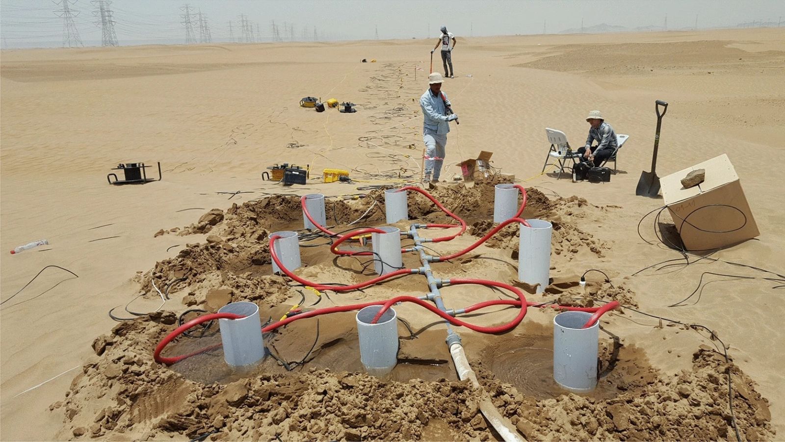
To validate the capabilities of seismic interferometry, Schuster and his team conducted a controlled experiment. They deployed sound sources and receivers atop a dry sand dune, injected approximately 12 tons of water into the dune, and recorded nearly 100 interferometric measurements per source location.
These measurements provided near-instantaneous snapshots of water movement a few meters below the surface. By collecting data every two minutes, the team successfully visualized subsurface water flow in real time.
“Our 3D simulations of the experiments confirm the accuracy of our findings,” Schuster states.
Future Applications
This innovative approach could revolutionize environmental engineering by enabling fast and cost-effective underground monitoring. Potential applications include real-time imaging of leaking dams and seismic surveys on extraterrestrial bodies like Mars or the Moon.
Schuster believes this groundbreaking technology holds transformative potential:
“These findings open doors to a wide range of applications, from environmental monitoring to space exploration.”
By enabling acoustic waves to detect complex subsurface structures instantly, this novel seismic imaging technique not only saves time but also paves the way for groundbreaking discoveries.